Category:Satellite pictures of the Indian subcontinent
Jump to navigation
Jump to search
Subcategories
This category has the following 9 subcategories, out of 9 total.
Media in category "Satellite pictures of the Indian subcontinent"
The following 11 files are in this category, out of 11 total.
-
 05B1999.jpg 750 × 555; 156 KB
-
 200807181028-vu2iia.jpg 909 × 1,000; 400 KB
-
 200807231359-iia.jpg 909 × 1,099; 487 KB
-
 Cyclone 05B 1999 India Bay of Bengal satellite image NOAA cropped.jpg 734 × 469; 283 KB
-
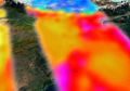 Ev203 indoex close co sm.jpg 512 × 358; 17 KB
-
Him.ogv 52 s, 352 × 240; 2.03 MB
-
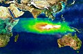 TOMS indonesia smog lrg.jpg 1,234 × 801; 337 KB
-
 Tropical Cyclone 3B (2003).jpg 5,600 × 7,200; 3.84 MB
-
 Typhoon Gay 08 nov 1989 0826Z.jpg 1,400 × 1,600; 483 KB
-
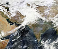 Western Disturbance - 3 February 2013.jpg 8,658 × 7,282; 35.92 MB
-
Western Europe to Central India.ogv 37 s, 840 × 560; 8.06 MB


.jpg)

